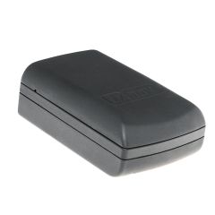
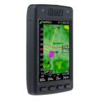
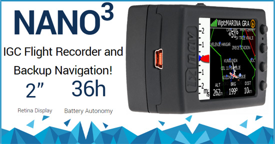
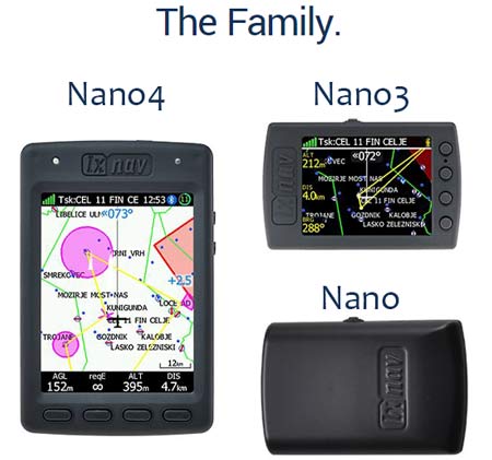
LXNAV Nano3 IGC Flight Recorder
Manufacturer Part Number: NANO3
No Additional Tariff Fee

LXNAV Nano3
General Description
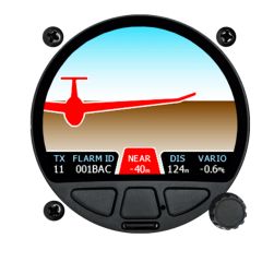
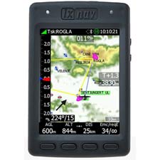
LXNAV NANO3 is the smallest IGC flight recorder with a QVGA screen. Fly without any cables and chargers! A 1800mAh battery serves up to 36h with advanced power management. The Nano3 has 4 push buttons for easy editing and a rocker button for setting volume/zoom and MacCready.
The built-in battery allows up to 25 hours of stand-alone operation. The battery can be charged when the flight recorder is connected to a computer, NanoPower or wall charger. Bluetooth is used for easy data exchange with a PDA.
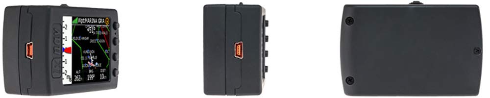
The housing is made of robust ABS plastic. On the left side of the unit, there is a rocker button and five status LEDs which display the operational status. A 4 GB solid state disk is used for flight data storage. Flights are stored directly in IGC format and are downloadable through a USB connection which is compatible with all operating systems (MS Win, Linux and Mac OS).
At the back of the unit, there is a mini USB connector which is used for charging and data transfer. The internal solid-state disk is preloaded with the NanoConfig program. This program is used for uploading a flight declaration and/or changing the settings of the NANO3. Flight declarations can also be uploaded using a serial interface cable or Bluetooth connection.
W&W typically stocks LXNAV Nano3.
Features
- High–level IGC specification
- 2048–bit digital signature
- Advanced engine noise level recording (also for JET engines)
- Automatic power down after landing (can be set by the user)
- Start logging at power on (for paragliders or pedestrians)
- Up to 35 hours with advanced power management
- Up to 16 hours of operation with screen
- Unlimited storage for flights (+28000 hours at 1 sec interval)
- Flights stored in IGC file format are downloadable through USB, Bluetooth or Wi–Fi
- NanoConfig program for creating declaration and system settings (for PC and Android)
- Simple signaling LED’s for logger state, battery and GPS signal
- 2″ sunlight readable
- 340–pixel–by–240–pixel resolution
- 262144 Colors
- Integrated 1800 mAh Li–Ion battery
- Up to 36 hours of operation
- Battery charger via USB port
- 56–channel GPS receiver
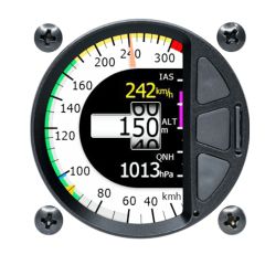
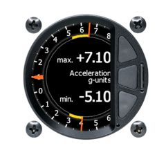
- High resolution variometer same technology as on V9/S80 vario
- High resolution pressure altitude sensor measures up to 16000m (~52500ft)
- Inertial platform 3 axis accelerometer and 3 axis gyroscope
- Advanced engine noise level sensor (also for JET engines)
- Plug & Play USB interface (mass storage device)
- USB compatible with all operating systems (MS Win, Linux, Mac OS)
- Serial RS232 interface with NMEA output
- Bluetooth module (Android and iOS)
- Integrated Bluetooth LE4 device (SPP)
- Built–in speaker with adjustable volume
- 4 GBytes of solid state memory
- Robust ABS plastic housing

| Size And Weight | Height: 66 mm | Depth: 28 mm |
| Width: 43 mm | Weight: ~76 g | |
| Flight Recorder | Specification | Recording |
| High-level IGC specification | Advanced engine noise level recording (also for JET engines) | |
| 2048-bit digital signature | Automatic power down after landing (can be set by user) | |
| Start logging at power on (for paragliders or pedestrians) | ||
| Durability | Flight Storage | |
| Up to 35 hours with advanced power management | Unlimited storage for flights (+28000 hours at 1 sec interval) | |
| Up to 16 hours of operation with screen |
Flights stored in IGC file format are downloadable through USB, Bluetooth or Wi-Fi | |
| Software Support | LED Indication | |
| Nanoconfig program for creating declaration and system settings (for PC and Android) | Simple signalling LED’s for logger state, battery and GPS signal | |
| Navigation | Modes | Final Glide |
| Info | Final glide indication | |
| Flarm | MC setting | |
| Waypoint | Ballast setting | |
| Thermal | Bugs setting | |
| Setup | Polar selection | |
| Near mode | ||
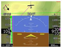
| Airspace | Additional | |
| Airspace Display | Wind indication | |
| CUB compatible or from LXNAV database | Task and waypoint navigation (CUP compatible) | |
| Airports from LXNAV database | ||
| Select among many navboxes | ||
| Flarm | ||
| Indication of Flarm/ADSB objects | ||
| Chip | ARM Cortex M4 CPU | |
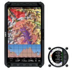
| Display | Retina display | |
| 2.0-inch sunlight readable | ||
| 340-pixel-by-240-pixel resolution | ||
| 262144 Colors | ||
| Power And Battery | Integrated 1800 mAh Li-Ion battery | |
| Up to 36 hours of operation | ||
| Sensors | 56-channel GPS receiver | |
| High resolution variometer same technology as on V9/S80 vario | ||
| High resolution pressure altitude sensor measures up to 16000m (~52500ft) | ||
| Inertial platform 3 axis accelerometer and 3 axis gyroscope | ||
| Advanced engine noise level sensor (also for JET engines) |
||
| Connections | Plug & Play USB interface (mass storage device) | |
| USB compatible with all operating systems (MS Win, Linux, Mac OS) | ||
| Serial RS232 interface with NMEA output | ||
| Bluetooth module (Android and iOS) | ||
| Integrated Bluetooth LE4 device (SPP) | ||
| Speaker | Built-in speaker with adjustable volume | |
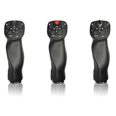
| Buttons | 1 x Push and lever | |
| 4 x Navigation | ||
| Storage | 4 GBytes of solid state memory | |
| Material | Robust ABS plastic housing |
- NANO3 flight recorder with preloaded NanoConfig program and user manual which is loaded on the USB stick
- NanoPower cable
- USB cable
- Wall charger
- Barogram calibration chart
- Quick reference char
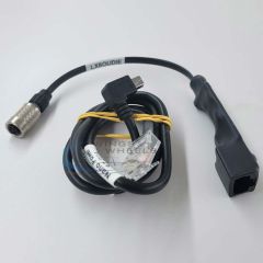
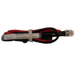
- Nano Power - Nano power cable for Nano, Nano3/4
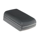
- Nano Wall Mini for Nano3
- NANOBAT - Nano3 Battery
- NP-Oudie - Nano cable for Oudie (Nano power with Oudie mini USB connection)
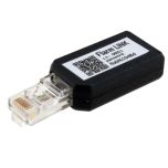
- NANOPOWER-FL - Nano cable for Flarm (Nano power with FLARM RJ11 connecto - supplied from flarm side)
- NANOPOWER-PF - Nano cable for Power Flarm (Nano powe with Power Flarm RJ45 connector - supplied from flarm side)
- S7-GPS-NANO - S7 Vario GPS cable for Nano
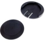
- Nano3mount - Mount for Nano 3
Compare and Decide
| Nano | Nano3 | Nano4 | |
 |
 |
 |
|
| Screen | No Screen | 2.0″ Diagonal 1.6x1.2″ (41x30.5 mm) Area: 1251 mm² pixels: 320x240 |
3.5″ Diagonal 2.1x2.8″ (53x71mm) Area: 3763 mm² pixels: 480x640 |
| Dimensions | 60x40x20 mm (2.36x1.57x0.79″) |
65x42x22 mm (2.6x1.7x0.9″) |
65x105x17 mm (2.6x4.1x0.7″) |
| Battery Life (Hours) | 35 | 13 to 25 | 14 to 36 |
| IGC Approved GPS Flight Recorder |  |
|
|
| Variometer using built-in pressure sensor | |
|
|
| Moving map with airports, airspace & tasks | |
|
|
| Final Glide to selected airport and around a task | |
|
|
| Reachable Airports Highlighted on Map | |
||
| Detailed map with terrain, cities, lakes, rivers, etc. |
North Up Only |
||
| Elevation Database - can display AGL altitude | |
|
|
| Receives and Displays FLARM traffic from connected FLARM | |
|
|
| Receives and Displays PCAS transponder traffic from connected PowerFLARM | |
|
|
| Edit settings in PowerFLARM | |
|
|
| Thermal Assistant | |