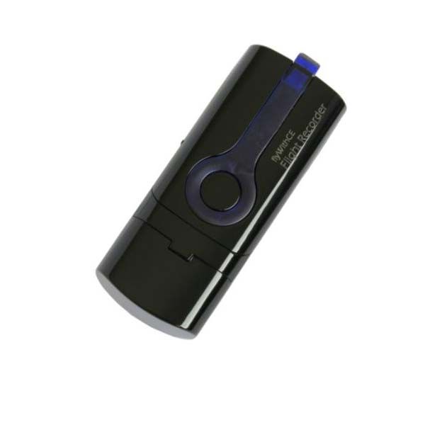
flyWithCE Flight Recorder Device
FlyWithCE Flight Recorder and Logbook
Meet the Most Popular Position Recorder
General Description
flyWithCE Flight Recorder is the smallest and most popular position recorder on the market. Wings & Wheels is proud to be an authorized flyWithCE Distributor.
W&W typically stocks FlyWithCE Flight Recorders.
Device Certifications
All competitions require signed IGC file. With the flyWithCE Flight Recorder device you have to make sure that you are connected to the Internet when you are downloading flights from the device and that the flyWithCE Logbook application has displayed Online status in status line. The signed IGC file will be then generated automatically.
FAI position recording
The International Gliding Commission (IGC) introduced a new class of recorders - position recorders. Position Recorder approval is issued by national gliding committee for specific device. Pilots can claim Silver and Gold FAI badges.
Because flyWithCE Flight Recorder is using GPS to detect altitude, the pilot must gain extra 100 meters to compensate for possible altitude error (example: the gain of height is at least 1100 meters for Silver altitude). For more information about position recorders, please check documents published on the FAI web page.
FlyWITHCE Logbook will run on Windows operating systems (Windows Vista or newer).
Internet connection is required to generate secure IGC files.


Easy to use
With ON/OFF and pilot event switches device is extremely easy to use. A few minutes before flight turn on the device and when a valid GPS position is detected device will start recording your flight.
Secure recorder
The device will record standard IGC files which can be viewed with any IGC viewer. Together with the device you will get the flyWithCE Logbook software which can be also used to view downloaded flights.
Certified position recorder
In several countries device is certified as FAI position recorder and there pilots can use recordings to claim Silver and Gold FAI badges. It is also certified for online competitions (CIVL and OLC).
Power independent
With internal rechargeable battery you will not be dependent on planes power supply.
Small size
It is one of the smallest and lightest flight recorders on the market.
Inexpensive
Check Order page for a price which is much lower than any other flight recorder currently on the market.
| flyWithCE Flight Recorder FR300 | |
|---|---|
| Memory size | 71 hours with 1 s recording interval |
| Recording interval | adjustable 1 – 30 seconds |
| Battery power | built-in 450mAh rechargeable battery |
| Battery operation | >10 hours |
| Size | 78 mm x 28 mm x 18 mm |
| Weight | 32 grams |
| Built-in GPS antenna | yes |
| RoHS | yes |
| Pressure altitude sensor | no |
| Engine noise level sensor | no |
| Full IGC certification | no |
| FAI position recorder certification | yes |
| CIVL certification | yes |
| OLC accepted | yes |
| Supported operating system | Windows (from Windows Vista) |
| Warranty | 1 Year |
Logbook Software
Download, store, view, analyze and share flights.
Flight statistics
Optimize flight task and check flight statistics.
Flight database
Download flights from the flyWithCE Flight Recorder or import your IGC files recorded with other devices.
Share flights
Convert IGC files to formats that can be opened on almost every PC and then Email them to your friends.
Share flights
Flights are usually saved as IGC files and on most computers you do not have IGC viewer installed. Even your glider friends might not have installed the appropriate viewer program an all PCs. Because of that it is important that you can send flight in some more common format where the viewer is already installed or it is easily available and it is free of charge.
Google Earth is a free program that can display KML file format. You can review flight track in 2D or 3D. The program will also display graph with altitude and speed.
Google Maps is the most portable format. The Logbook will generate an HTML file which can be displayed in any web browser as long as you have an Internet connection.
Select file that you would like to Email to your friend and Logbook will select the appropriate IGC file and if requested change format to Google Earth or Google Maps.
OLC online competition
flyWithCE Flight Recorder is registered as position recorder. Approval is displayed on this OLC web site.
Some competitions on the OLC web site require fully certified IGC flight recorder. Please check the contest rules before you will take part in certain competition.
CIVL open validation server
The Open Validation Server is a free online service for validating IGC files, used by the FAI CIVL World XC Online Contest and many other national and international flying contests. flyWithCE Flight Recorder is approved CIVL position recorder.


